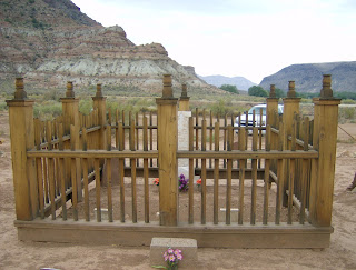
Yesterday Clarine and I drove to Iosepa. Going there, we went to Grantsville, thence south along the Oquirrh Range via St. Johns and Clover (Rush Valley). We then went over the mountains to Dugway. (Just outside the military post, there is a beautiful LDS chapel. I suppose it is to accomodate the post, ranchers and sellters in the west desert vicinity.) My father used to own stock in Deseret Livestock Company. I remember he used to get a small dividend check from time to time. That firm has evolved into what is now Ensign Rranches and they have a large livestock presence in the area. At Dugway we followed the Old Lincoln Highway north for sixteen miles to Iosepa. (Hawaiian for Joseph, named after Joseph F. Smith, who was a beloved missionary there for several years before he turned twenty. Many Hawaiians came to the Salt Lake City area to be near a temple before the temple in Hawaii was built. They made a settlement at Iosepa. After the temple in Hawaii was completed, Iosepa sort of went away. In the last few years there are those who want to remember Iosepa and the cemetery are kept up, and picnic and camping areas have been set up there. Some of Clarine's family have been to youth Conferences out there. Any way we enjoyed visiting the place. There is sort of a melancholy, nostalgia there. We returned to Stansbury Park by continuing north to I-80 at Timpie. Then we completed the circle by traveling back home via I- 80.

This is one of the signs designating Iosepa.
An informational sign at Iosepa.
Back of Iosepa sign
Highway sign for Iosepa.
Clarine sitting in pavillion at Iosepa. (Can you see the basketball hoop just to the left of her head?)
George and the expanse of the cement floor in the pavillion.
The stage at the north end of the pavillion
(restage)
The most recent headstone I saw in the cemetery.
The kitchen facilities looking from under the pavillion
A monument to one of the female "driving forces" at Iosepa
Utah State Historical marker (unrotated) - kitchen in the background


